Multi Criteria Site Selection

We provide comprehensive multi-criteria site selection studies and regional spatial analysis, leveraging advanced mapping and data-driven methodologies to evaluate and compare multiple locations.
By integrating diverse place evaluation criteria—such as accessibility, land use compatibility, environmental impact, infrastructure readiness, and socio-economic factors—we deliver actionable insights that guide informed decision-making. Our approach combines GIS-based spatial analysis with customized evaluation frameworks to identify optimal sites that align with project goals and strategic priorities.
This robust methodology enables stakeholders to assess the relative strengths and limitations of each site, ensuring that final selections are not only data-supported but also tailored to the unique requirements of the project and the regional context.

The scope of the following case study was to perform geographic mapping and analysis of several international locations to assist the client in identifying vacant and semi-vacant lands for development opportunities.
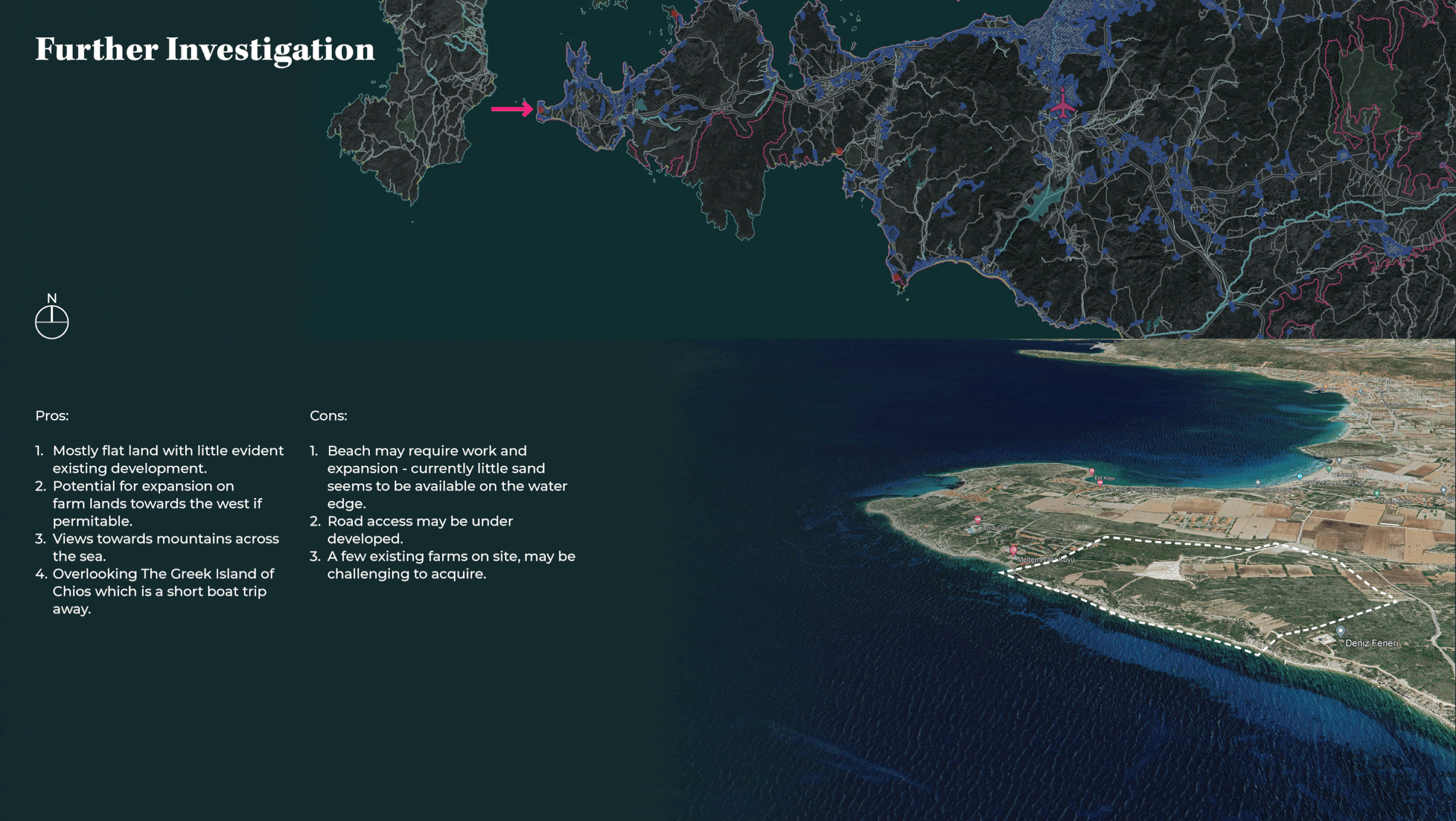
Several locations were assessed, mapped and compared based on the following criteria:
-Distance from international airports (Approx 1 hour drive)
-Road accessibility and connectivity
-Beach access
-Altitude / topography
-Environmental opportunities
-Views and visibility
-Distance from existing settlements and commercial activity

Data Gathering
Search and gather relevant data from open data resources
Review and collate data provided by the client and private entities.

Data Management
Review, compare and clean data sets in preparation for processing and analysis
Assist with data structuring
Compile and merge data sets where needed for ease of use

Data Analytics
Perform mathematical and geometrical processing on different datasets to draw conclusions

Data Visualization
Converting raw data into legible maps, graphs and charts to help understand different parameters
Mapping data based on geo-references