Advanced Collaboration

We excel in enabling real-time collaboration and iterative design processes through advanced web-based tools, fostering seamless communication among stakeholders regardless of location.
By integrating interactive data visualization platforms, we transform complex spatial and urban data into intuitive visual formats that support shared understanding and informed decision-making.
We use tools to empower teams, by exploring design scenarios, assess impacts, and refine concepts collaboratively in real time.
Our approach ensures that iterative feedback loops are efficient and transparent, reducing delays and enhancing the quality of outcomes.


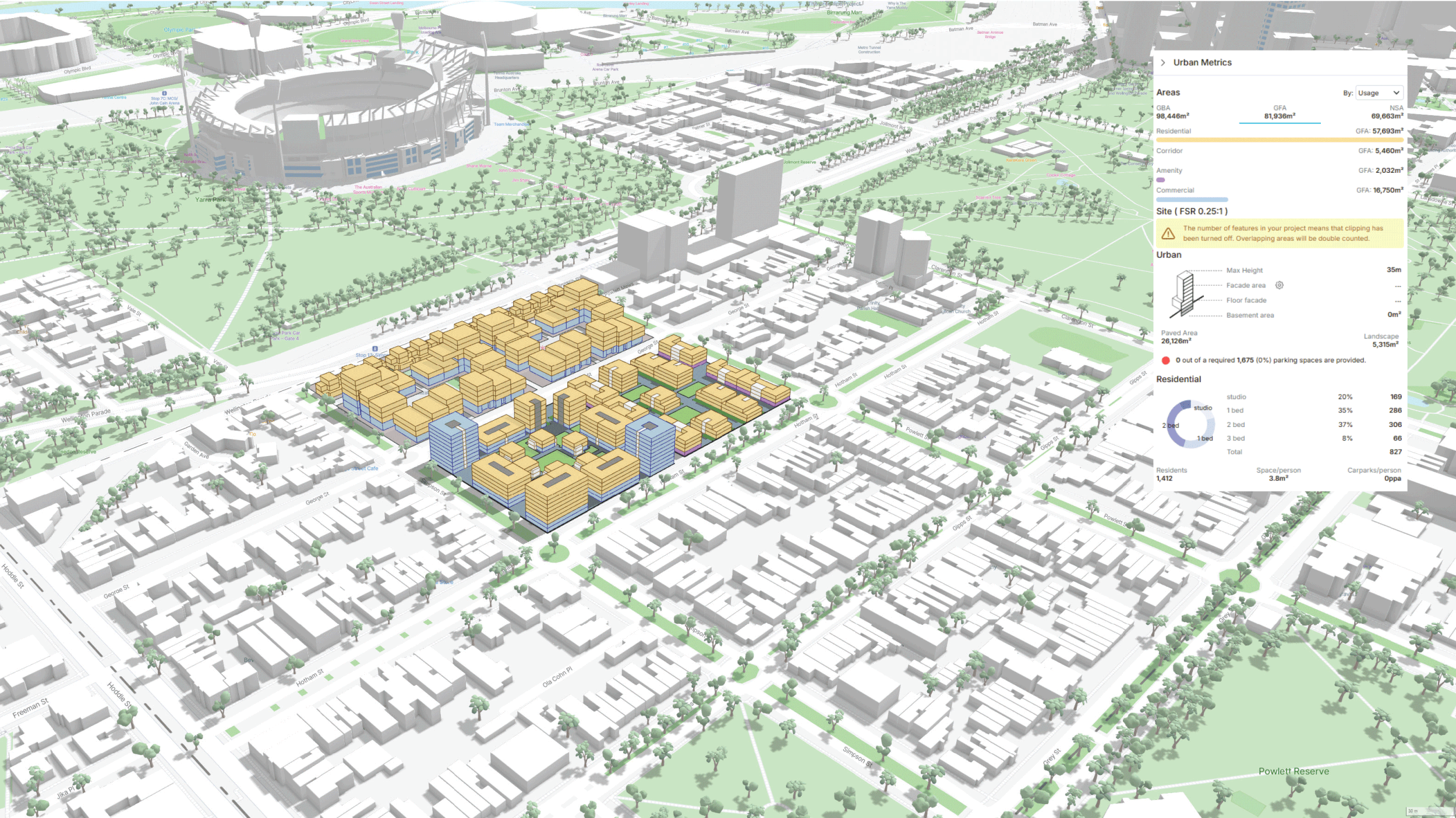
Rapid iteration capabilities enabled collaboration for urban block attribute design.


Data Gathering
Search and gather relevant data from open data resources
Review and collate data provided by the client and private entities.

Data Management
Review, compare and clean data sets in preparation for processing and analysis
Assist with data structuring
Compile and merge data sets where needed for ease of use

Data Analytics
Perform mathematical and geometrical processing on different datasets to draw conclusions

Data Visualization
Converting raw data into legible maps, graphs and charts to help understand different parameters
Mapping data based on geo-references